Structure of Plant Community along the Mekong River, Thailand
Keywords:
Plant diversity, Mekong river, Riparian forestAbstract
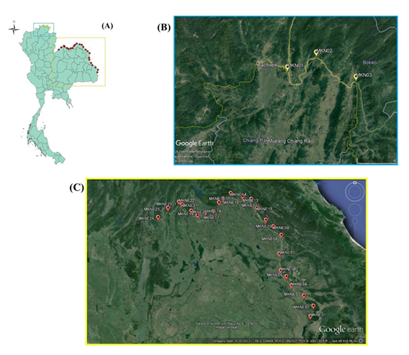
This research was conducted since 2010. It primarily aimed to study the structure of plant community along the riverbank of the Mekong River that runs through the border of the country. 28 sampling points were selected for the study. The temporary sample plots of belt transects (comprising the subplot of 10x10 m2, totaling 293 subplots) were placed perpendicular to the shore all the way to the river. Trees, saplings and seedlings were identified, measured, and counted the numbers. 155 plant species (all trees and undergrowth plants) from 119 genera and 48 families were found. Of these, according to Pooma et al. (2005), 2 species of the plants treated as Threatened species, Artabotrys spinosus and Sauropus heteroblastus, were found. The Important values of the first three tree species were: Ficus racemosa (42.49%), Lagerstroemia sp. (20.75%) and Muntingia calabura (19.76%), respectively; that of tree saplings were Leucaena leucocephala (84%), Crateva magna (19.27%) and Barringtonia acutangula (16.64%), respectively; and that of tree seedlings were L. leucocephala (72.31%), Streblus asper (22.92%) and M. calabura (14.41%), respectively. Six types of the forest floor could be classified i.e. 1) sandy beach, 2) pebble beach, 3) small sand pockets with rocks, 4) rocky areas, 5) sandy-loam riverbank and 6) man-made riverbank (6). The sandy-loam riverbank was the most common type of forest floor along the Mekong River.
Downloads